How a Water Depth Sensor Improves River Monitoring Accuracy
Challenges in Traditional River Monitoring Methods
- Challenges in Traditional River Monitoring Methods
- Understanding Water Depth Sensors and Their Principles
- How Water Depth Sensors Enhance River Monitoring Accuracy?
- Selecting the Best Water Depth Sensor for River Monitoring Needs
- Future Trends in Water Depth Sensor Technology for River Monitoring
- Conclusion
- FAQ
- Partner With GAMICOS for Precision Water Depth Sensor Solutions
- References
Modern methods for managing water resources, preventing flooding, and running factories that depend on accurate hydrological data depend on accurate river tracking. A water depth sensor changes this important job by giving accurate, real-time readings that get rid of the errors that come with older tracking methods. These water depth sensors give you millimeter-level accuracy that you need to make smart decisions by turning hydrostatic pressure into electrical messages. This guide answers the questions that purchasing managers, engineering teams, and distributors have about finding reliable measurement solutions that meet strict regulatory requirements across a wide range of industrial uses while also improving working efficiency.

Challenges in Traditional River Monitoring Methods
For a long time, traditional methods of river tracking have focused on measuring by hand and visual observation, both of which have big problems with accuracy. Measuring results can be off because of human mistake, especially when techs have to go to dangerous or remote places in bad weather. Environmental factors like turbidity, sediment transport, and fast flow variations make statistics even less reliable.
The Cost of Inaccurate Water Level Data
When measurement methods don't work right, it puts at risk the operations of industries that count on accurate hydrological information. Incorrect readings can cause the wrong flood reaction protocols to be used, which can damage property and raise safety issues. For chemical dosing to be accurate and treatment to work well, water treatment plants need exact readings of the water coming in. Power companies that use river water for cooling need accurate level data to keep their expensive equipment from breaking down because of quick changes in the water supply or lack of it.
Regulatory Compliance Pressures
Environmental groups and water management officials are asking for more and more continuous, checkable tracking data to make sure that rules about discharge and environmental protection are being followed. When you measure things by hand, there are gaps in the data that mean you don't see important events like quick changes in level or contamination. These gaps in compliance put organizations at risk of fines and damage to their reputations, and they make it harder for them to show partners and communities that they are good water caretakers.
Understanding Water Depth Sensors and Their Principles
Modern level measurement technology uses a number of different measuring methods, each of which has its own benefits for different tracking situations. When procurement teams understand these basic technologies, they can choose options that meet their business needs and work in their specific setting.
Pressure-Based Measurement Technology
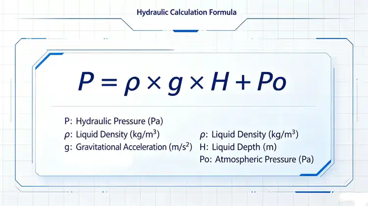
The idea behind submersible water depth sensors is that hydraulic pressure is directly related to the depth of the liquid. The basic relationship is shown by the equation P = ρ × g × H + Po. This means that the pressure at the water depth sensor surface is equal to the density of the liquid times the acceleration of gravity times the depth, plus the pressure of the air above the liquid. The water depth sensor's diaphragm picks up changes in pressure that match to changes in the water level when it is set in place below the surface. By changing the shape of the material, silicon piezoresistive water depth sensor cores turn this mechanical pressure into proportional electrical signals. This lets the level be calculated continuously and very accurately.
Technical Specifications That Matter
Resolution decides the tiniest change in level that a water depth sensor can pick up. Newer water depth sensors can reach millimeter-level sensitivity, which is important for tasks that need precise measurements. The operating depth limits are set by the measurement range, which can be anything from shallow stream tracking to deep reservoir uses. Temperature adjustment systems keep measurements accurate even when temperatures change with the seasons and every day. Without these systems, measurements would become inaccurate. There are different signal output options, such as 4-20mA, 0-5V, and digital protocols, so it can work with current data acquisition infrastructure. There are also different material building options to meet the needs of corrosion protection in different types of water.
Integration With Monitoring Systems
These days, keeping an eye on rivers requires that data be easily combined with tools for supervisory control and data collection. Standard industrial signals from water depth sensors can be sent straight to programmable logic controls and remote terminal units, so there is no need for complicated signal conditioning. This compatibility lets data be automatically recorded, visualized in real time, and alarms go off when levels go above certain limits. This turns raw readings into useful information that helps with quick operational reaction.
How Water Depth Sensors Enhance River Monitoring Accuracy?
Advanced tracking technology gets around the main problems with human monitoring by taking accurate measurements all the time that show how river systems change over time. From regular human readings to constant automated tracking, the change is a big deal for both the quality of the data and the ability to run the business.
Real-Time Data Eliminates Measurement Gaps
Continuous sensing picks up on short-lived events that are missed by human tracking. Flash flooding happens very quickly and needs to be tracked at the second-by-second level so that emergency services can respond quickly. Continuous flow tracking in industrial intake systems finds sudden changes in flow that could mean an event upstream or a problem with the equipment. This level of detail in time is very helpful for water resource managers who have to plan when to release water from reservoirs, when to water crops, and how much water needs to flow downstream in large, complicated river systems.
Reduced Human Error and Safety Improvements
When you use automated measurement, you don't have to worry about transcription mistakes, misreading gauge marks, or differences in how different viewers see the same data, which can happen with manual methods. Field workers no longer have to worry about getting hurt when they go to measurement places during heavy traffic or bad weather. The ability to watch workers from afar keeps them safe and keeps data flowing even when conditions are dangerous. This meets the needs of both accuracy and safety at work, which are important issues for engineering managers and project directors.
Wireless Technology Enables Remote Monitoring
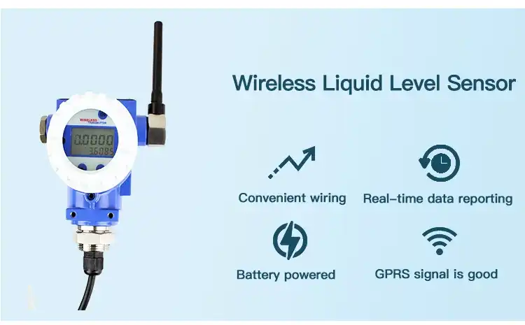
Adding wireless communication methods to measurement points turns them from stand-alone systems into networked tracking systems. When water depth sensors are connected to a central platform via LoRa, GPRS, NB-IoT, or 4G, they can send data without having to physically visit the spot or use hardwired links. This feature is especially useful for keeping an eye on networks that cover large amounts of land or are in remote areas where the cost of setting up the necessary equipment would make it impossible to get full coverage otherwise. When purchasing managers look at the total cost of ownership, they see that wireless systems lower ongoing running costs while making data easier to reach.
Selecting the Best Water Depth Sensor for River Monitoring Needs
When making procurement choices, you have to weigh a lot of performance standards, cost factors, and long-term support needs. Structured evaluation systems that put the factors most important to engineering managers and sourcing workers at the top of the list help them do their jobs better.
Critical Performance Parameters
The standards for measurement accuracy must match the needs of the application, keeping in mind that too much precision raises costs without adding much value. How stable water depth sensors are after being submerged for a long time affects their ability to stay calibrated over months or years of constant use, which has a direct effect on repair schedules and lifecycle costs. Durability against mechanical stress from debris impact, sediment abrasion, and flow forces saves investments in difficult river settings where equipment failure interrupts tracking functions that are very important.
The GLT500 Submersible Solution
The GLT500 submersible water depth sensor is an example of river tracking technology that was made to work in tough industrial settings. This small device has a very reliable silicon piezoresistive water depth sensor core, as well as digital correction circuits that can be programmed, automatic temperature adjustment, and signal processing that gives standard industrial outputs. Its all-stainless steel structure keeps the accuracy of the measurements even in tough environments.
The multi-layer safety structure is well liked by engineering teams because it lasts a very long time against impacts and rust. The anti-clogging liquid entry design has pressure vent holes that make the service life longer by stopping sediment blockage, which is a typical way for river uses to fail. Different installation needs can be met by the different pressure ranges and signal output setups, which avoid the need for special engineering.
Customization options let you solve unique measurement problems with wear-resistant, oil-resistant, and acid-alkali-resistant wire choices. High-strength venting cable designs keep the accuracy of the air pressure reference even when there are long cable runs or difficult route conditions. Because it is so flexible, the GLT500 can be used for water conservation projects, networks that watch the environment, and industry process applications where choices about how to run the business are based on accurate level data.
Evaluating Supplier Capabilities
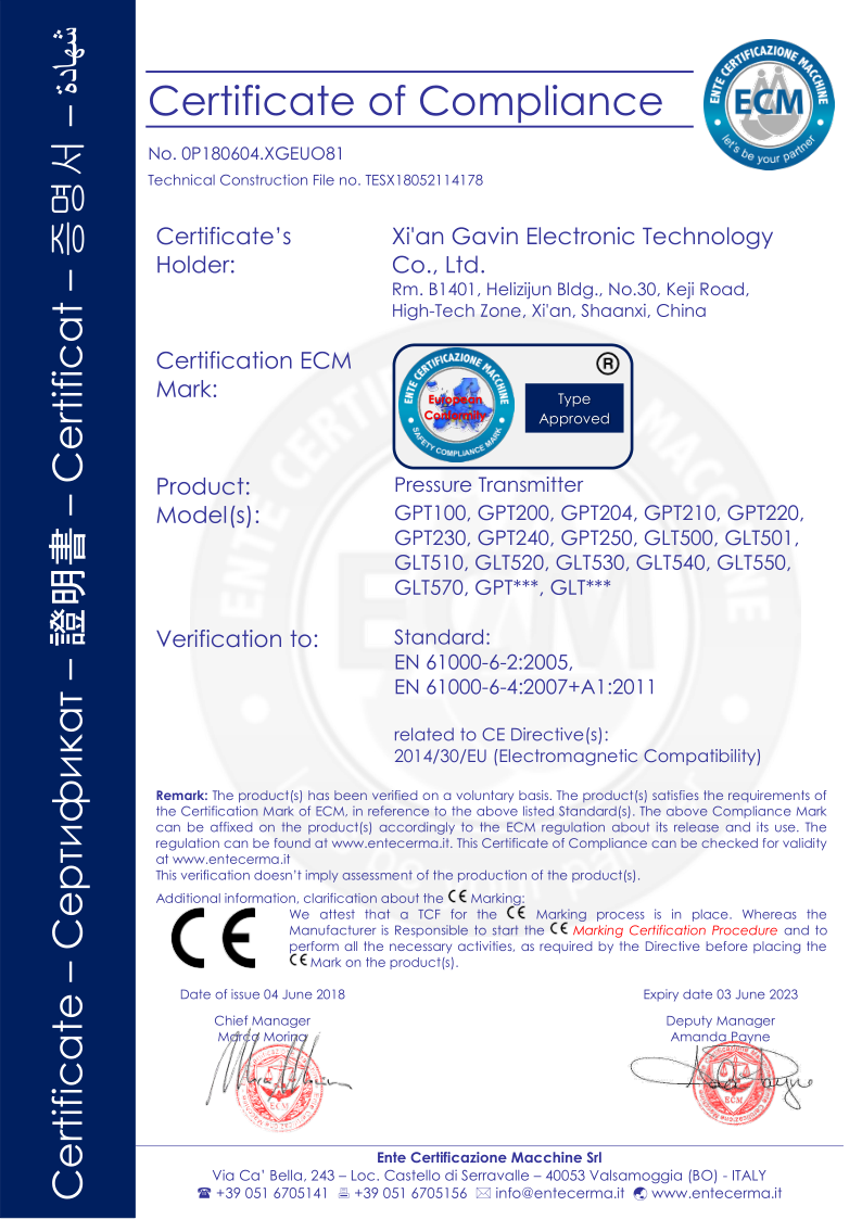
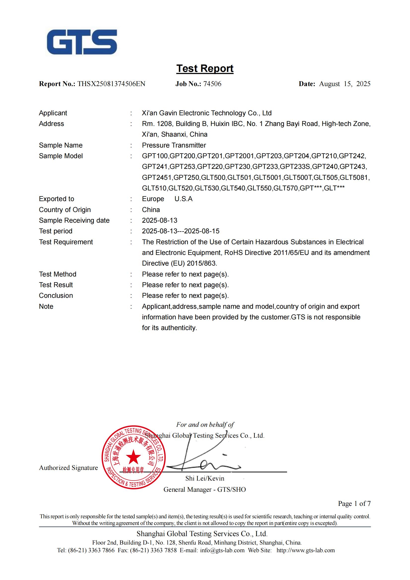
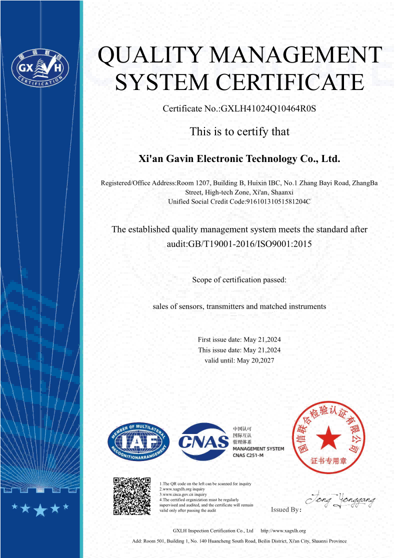
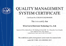
Beyond product specs, the quality of the supplier relationship also affects how well the procurement goes. The ability to supply in bulk makes sure that there is always enough for big projects or operations that span multiple sites, without transportation delays that throw off project schedules. Compliance with international licensing standards, such as CE, RoHS, and ISO, makes the approval process easier for regulators and lowers the risk of buying something. When installation questions come up or fixing help is needed, responsive expert support and full after-sales service keep operations running smoothly.
Future Trends in Water Depth Sensor Technology for River Monitoring
Level measurement tools are always changing as technology advances. This gives early adopters the chance to gain competitive benefits through better data quality, lower running costs, and better analytical tools.
IoT Integration and Smart Platforms
Internet of Things architectures allow water depth sensor networks to share data across company lines. This makes it easier for many people to work together to handle water resources. Cloud-based systems collect data from many water depth sensors and use analytics tools to find patterns, predict events, and make the best use of resources. Machine learning models that have been taught on past data can find outliers that could mean that equipment isn't working right or that the water levels aren't normal. This lets for proactive maintenance and quick response to incidents.
Energy-Efficient Low-Power Designs
Energy-harvesting water depth sensors that run on batteries make application choices wider in places that don't have access to electricity. Low-power electronics and clever job cycling extend the life of equipment between repair periods, which lowers the total cost of ownership for networks that watch things from afar. These improvements are especially helpful for distributors and system designers who work with customers in developing areas or areas that are sensitive to the climate and can't build new infrastructure.
Enhanced Connectivity Standards
Next-generation wireless methods are better than older ones in terms of range, ability to get through obstacles, and power economy. With mesh networking, you can make water depth sensor networks that can fix themselves even if some of their communication lines fail. Standardized data formats and open APIs make it easier to connect to systems from other companies. This lowers worries about being locked into one provider and protects long-term technology investments.
Conclusion
The accuracy of river tracking has a direct effect on how well many businesses run, how well they follow the rules, and how well they take care of the environment. Modern water depth sensors get around the problems with older ones by collecting data continuously and in real time, running themselves automatically, and connecting wirelessly. This turns single readings into complete tracking networks. The GLT500 submersible water depth sensor shows how purpose-built technology can solve real-world application problems while giving procurement workers the accuracy, durability, and customization choices they need. By carefully choosing water depth sensors based on their performance specs, the skills of the provider, and new technology trends, businesses can take advantage of better data quality that helps them make better decisions and run their operations more smoothly.
FAQ
Q1: What accuracy levels can modern water depth sensors achieve in river monitoring applications?
A: These days, pressure-based water depth sensors can usually provide resolutions of a few millimeters, which is fine for most environmental and industry tracking needs. The accuracy of the measurements relies on the quality of the water depth sensors, how well they are installed, and how they are calibrated for the conditions at the spot. The GLT500 water depth sensor has automatic temperature compensation and customizable digital correction that keep it accurate in a wide range of environmental conditions. This stops thermal drift issues that happen with designs that aren't adjusted.
Q2: How do pressure sensors compare with ultrasonic technology for river level measurement?
A: Ultrasonic waves can't bounce off of debris, foam, or rough surfaces, but water depth sensors work great in those situations. Weather factors, wind, or changes in the air temperature that make non-contact measurement methods less accurate don't affect designs that are submersible. When measuring acidic substances or liquids that could be contaminated, ultrasonic water depth sensors are better than other types of sensors. However, these benefits don't usually apply to natural bodies of water.
Q3: What installation and calibration practices ensure optimal sensor performance?
A: If you choose the right place to put something, you can avoid places with a lot of turbulent flow, sediment buildup, or hits from debris that could damage the equipment or cause measurement mistakes. Water depth sensors need to be placed in a stable way at regular levels and have enough air flow through special wires to let the atmospheric pressure out. Initial calibration against known reference readings and regular verification against manual gauging sets the standard accuracy and finds calibration drift that needs to be fixed.
Partner With GAMICOS for Precision Water Depth Sensor Solutions
GAMICOS specializes in providing high-precision measurement technology that was made to meet the needs of challenging river tracking applications. Our many years of experience working with clients in 98 different countries shows that we can solve the problems that buying teams and tech managers face every day. The provider of the GLT500 submersible water depth sensor gives monitoring networks the dependability, customization options, and technical performance that turn them from data collection systems into strategic operating assets.
Contact our technical team at info@gamicos.com to talk about your unique monitoring needs and look into options that are made to fit your application setting. We offer full support throughout the whole buying process, from coming up with the initial specifications to helping with installation and providing ongoing expert support. Our OEM and ODM services provide fully customized solutions with fast rollout and low technical risk. These solutions include custom cable setups, communication methods, and integration support.
References
1. Anderson, M.P. & Woessner, W.W. (2015). Applied Groundwater Modeling: Simulation of Flow and Advective Transport. Academic Press.
2. Brassington, R. (2017). Field Hydrogeology. 4th Edition, John Wiley & Sons.
3. Herschy, R.W. (2014). Streamflow Measurement. 3rd Edition, CRC Press.
4. ISO 4373:2008. Measurement of Liquid Flow in Open Channels—Water Level Measuring Devices. International Organization for Standardization.
5. Strangeways, I. (2010). A History of Rain Gauges and Water Level Measurement. Weather, Vol. 65, Issue 5, pp. 133-138.
6. Webster, J.G. (2019). The Measurement, Instrumentation and Sensors Handbook. 2nd Edition, CRC Press.

Halen
With over 12 years of experience in fluid sensing technology, Halen specializes in helping clients select and optimize oil level sensors for a wide range of industries—including automotive, marine, heavy machinery, and energy.
We're here to help — submit your request anytime!
Let us know how we can help solve your pressure level measurement challenge.
_1757930850792.jpg)
Recommended Blog
How Submersible Pressure Sensors Improve Closed Chemical Tank Safety
Water Level Sensor Probe Maintenance Tips for Longer Service Life
How Submersible Pressure Sensors Improve Closed Chemical Tank Safety
Water Level Sensor Probe Maintenance Tips for Longer Service Life
How Submersible Pressure Sensors Improve Closed Chemical Tank Safety
Water Level Sensor Probe Maintenance Tips for Longer Service Life
How Submersible Pressure Sensors Improve Closed Chemical Tank Safety
Water Level Sensor Probe Maintenance Tips for Longer Service Life
Why Hydrostatic Pressure Sensors Are Ideal for Water Level Measurement
Why Hydrostatic Pressure Sensors Are Ideal for Water Level Measurement